
POLL NOW CLOSED – Thanks to everyone who voted.
Many of us rely on technology to find our way to our chosen holiday destination – but how much?
In this month’s community poll we’d like to know how you navigate to your chosen campsite when towing your caravan or driving your campervan or motorhome.
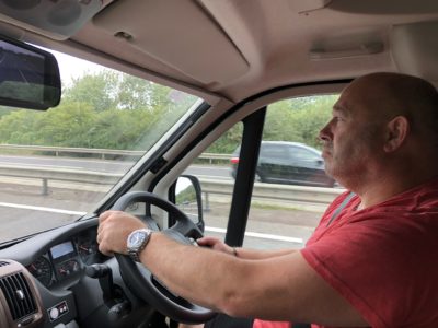
Your tow car or motorhome might have a sat nav installed, you might have a windscreen mounted caravan or motorhome specific portable sat nav or do you prefer the convenience of a smartphone app? Or you might place your trust in a map, rather than the technology, or even combine both to be super sure you’ll reach your landing place?
Let us know you how you get you and your leisure vehicle to your holiday destination by selecting one of the options below.
We’d also love to hear of any stories where your sat nav or map reading skills have taken you down a wrong or inappropriate route or given you problems on the road. How much trust do you place in the technology? Simply let us know by commenting in the box below.
We’ll report back the results in August.
DOWNLOAD ROUTE BEFORE JOURNEY
Locate the site on Google Earth, use Google Earth to follow the road, to spot any potential hazards, make a note of any detours I want to take to avoid them. On the journey use the in car satnav as back up and follow the route I have planned and written down. Satnav usually catches me up and does the redirection. I admit to being old school and love a map, but a mix of modern technology keeps me out of trouble, I also have the time to do it. Not the first time I have used the old fashioned road map to get out of a tailback of traffic.
Combination of map recce, windscreen mounted SatNav and CoPilot Truck Navigation App on my phone. To be honest the phone app is best as can set for vehicle dimensions whereas the SatNav has a tendancy to select narrow lanes etc
I use CoPilot GPS which for £25 a year allows you to enter your unit details (length/width) and then calculates routes based on that. Been excellent so far.
I use a Garmin sat nav that allows you to input the size of the motorhome, at times I find the route calculated goes a bit off course, to help ensure that doesn’t happen too often, we plot the route in google maps (this usually gives accurate real time traffice conditions), and at times the route maps we carry.
My wife and I started out camping with a caravan in the 70’s there were no Sat-Nav’s then and very few Club sites mostly Club Rallies mostly in little known rural locations so a road map and an OS map was a must, we caravaned extensively throughout the UK so reading a map was second nature but my job entailed me travelling to clients in towns and cities so finding their location was a pain so when TomTom launched its GO Sat-Nav in 2004 I was one of first to buy one in 2005 I’ve had three models the last of being the XL. Never really had a problem with them as always checked with the map first but then relied on Sat-Nav to get to front of door address. My next door neighbour is a HGV artic driver so when when we moved from caravaning to Motorhoming with a 7.5 Mtr vehicle in 2005 he advised me to get a Truckers road map to avoid low bridges and narrow winding roads. because that is the problem with Sat-Navs as by their nature they want to find you the shortest or quickest route so will alter the route en route which can be annoying, some in cab Sat-Navs if you don’t take their re-route won’t navigate you until you’ve come back onto planned route. I looked at getting a Sat-Nav specifically for large vehicles but was put off by the price and again HGV next door neighbour said they weren’t infallible he still carried Truckers map. I currently have a Garmin Drive 51 with 5” screen bought on price and lifetime maps still check new routes against Truckers map.
I use a Tom Tom 620 Truckers Sat Nav. On this you have the options of entering Car, Van & HGV Stats. as well as top speed. This means that when towing I can set the speed to, say, 57 mph and this then gives me a small allowance for any unexpected hold-ups. When driving just the car I use the ‘Van’ details, slightly over exaggerated, and a top speed of 65 mph. This has proved to be the best way to get to any destination on time and with constant updates of your arrival time. There is also useful display of filling stations,which covers motorway services, and their distance from you along your route – handy for a quick cupper or use of restroom..
We use the motorhome sat nav (portable) but set mobile phone google maps as back up as we have had some “interesting” routes with the sat nav.
I use a road map to plan for the majority of the route and then I use google mapping to get an idea of road features for the last few miles setting up our sat nav system and written instructions for the last few miles as normally when you get close to the sites their can be a lot potential hazards down country lanes. Also I normally phone the sirte for an approach route a few days before setting off.
Thanks for sharing your great tips Paul
I use TomTom Go app on my iphone, best sat nav app. Wish had weight, height and length settings for better routes for towing, I just stay on major roads. Tried some other app that had towing settings but found app usage nothing compared to TomTom
Use Google street view to check out any road junctions, which from a map/ route might need thinking about, ie filters, roundabout exits, tight turns into minor roads. Also to check narrow country roads and the final approach to site for signing and access. With a Bailey Cartagena, useful to have things like this to mind before setting off.
We use an Avtex Garmin Caravan and Motorhome Club edition. I discovered after being taken up what I deemed an inappropriate road (not wide enough for lorries and cars towing caravans passing with ease) that putting in the exact dimensions as the instruction state for route calculation can cause issues. I was advised by a techie at Avtex to oversize the unit. So, 6 inches taller, 6 inches wider, 1 foot longer and put the weight in at 3.6 tons will get usually the best routes. So now when I put in a destination, if there are two suitable routes up they pop and it’s a case of selecting the one we want. I would state however that if the caravan site says ignor your sat nav from a particular point and follow their directions- DO EXACTLY THAT. I’ve known folks think the sat nav knows best and found themselves stuck in a village or up a dead end.
Thanks for the tips Paul
i have a snooper with it you feel safe it covers height and how wide you are
For bigger rigs a specialist sat nav is always advisable. Driving a 7.5m Motorhome I prefer to hook my phone up via Apple CarPlay and use Google maps. Using it all day every day delivering cars up and down the country I know the app inside out BUT a general sense of direction is advisable as Google will try to take you along the shortest route and not necessarily the most Motorhome friendly one, so always be prepared to say ‘I know best here’ and ignore the turn instructions. With Google you can very easily ‘stack’ waypoints (destinations you want to visit en route), search for fuel stations and so on. I prefer it to Waze for its clarity and prefer it to my Pioneer built-in Sat-Nav as I find the interface ‘clunky’ by comparison.
I do not rely entirely on satnav. My first purchase was a Blaupunkt. It was a horror. Looking for a coastal village in Cornwall our satnav took us around a very large square area despite toad signs saying otherwise and pointed us to a tiny road marked’ farm traffic only’. We did not use it!
I use a map plus road signs to navigate, my husband says ” I don’t need satnav , I’ve got you!” and I can shout when he’s not listening.
I used my car sat nav on my very first caravan journey.It took us down a single road track.meeting a four wheel drive land rover coming towards us pulling well off the road into the ditch to let us past the gentleman told us we could turn round about a mile down the road he gave a big smile as he went past. Something told me I wasn’t the first !
We use a combination of a plug in Garmin motorhome Satnav ( it takes account of the size of the vehicle guiding you along appropriate roads) and a mobile phone ,as this provides more up to the minute assistance as to traffic delays via Google maps.
I use “what3words” it would be useful if sites quoted this on address information.
I had to replace my old and trusted TomTom as it was no longer being updated. Bought one of the new ones that, in theory, allowed you to plan a route on your PC and then save it to the satnav. It saved the routes with different names, i.e if you plotted route A to B it saved it as R to S. If you plotted several routes you then had to write a decoding list so that you knew that route R to S was in fact A to B. Useless. It also once turned me off the road onto a tiny dirt track. Needless to say it was sent back and I now have a Garmin. Works well, especially when using GPS co-ordinates which are incredibly accurate, but the verbal instructions are poor so you have to keep a careful eye on the screen. I use Google Earth to find the GPS co-ordinates and then store them in the satnav under Favourites.
I use the Garmin where I enter the size of my Motorhome
We used an app that was meant to take account of van size the same way Tony Harris described. What we discovered after a long awaited trip to Cornwall was there are are however way too many roads that are completely unsuitable for cars, never mind motorhomes or cars towing caravans i.e. regardless of how clever the app is if you tell it your going from A to B in Cornwall it’s going to have to take you on roads that once your on you’ll wish you weren’t! We made it in and out and travelled round about for 2 weeks but it was some of the most uncomfortable driving of my life. It makes me laugh coming from Scotland seeing questions from people re how to cope driving on single track roads in the highlands. Trust me a single track road in the highlands is easy compared to the roads in Cornwall i.e. single track roads in the Highlands are usually pretty visible for miles ahead and have passing places built in either side every 100/200 yards or so, Cornwall just seems to be mile after mile of of narrow twisty lanes that you can’t see round because they’re bounded by huge hedges.
We use a caravan specific garmin sat nav, but always use the map as confirmation. When planning the route I use street view to be absolutely sure we won’t get wrong slotted. The unit is big and going wrong is not an easy thing to put right.
Read a map before I leave . Always manage to remember. Last year managed to get around france ok. Who needs a sat navs. Your wasting your brain cells on tech
Last June we were driving north in our four berth motorhome, up the A1(M) near Darlington when we saw signs that the road ahead was closed. As advised we left the road at the next junction and followed the cars for a few miles to a cross roads. The mobile app told us to go right, the diversion signs told us to go straight on. As most of the cars in front went right we followed them and were horrified to find that within half a mile the road had narrowed to single track with grass verges on both sides and a ditch on the near side. Very quickly it became apparent that diverted traffic going south was using this road too. I was terrified! My husband did amazingly well, slowly driving past the oncoming cars with the wing mirror pulled in while I hung out of the window telling him how far he was from the ditch. This went on for about five miles! We were both exhausted and vowed never again to ignore diversion signs in favour of my map app when we’re in the van!
Thanks for sharing Roberta – sounds like a terrifying journey. Pleased to hear you escaped without accident or injury.
I use an app specifically for caravans as car sat navs don’t take into account size of units
I use a avtec 660 Garmin based with lifetime updates fantastic sat nav the best I have ever owned and can change from motorhome to car and it will alter the routes for weight height etc may be expensive to buy but I have up to know had 3 full European update of new mapping from 2015 to 2021 just received always look at my favoured routes on map first and the sat nav has always been spot on
I use one of the Snooper range of satnav making sure to keep it updated, the main reason for using it Is it can be set up for height length and also towing as we tow a small car if we are staying on one site for any length of time also it takes into consideration the height of your Motorhome and plots the route accordingly